Disaster resilience is a national imperative. To facilitate realizing disaster resilience, we strive to innovate and develop integrated Remote Sensing and Computing Technologies that can be rapidly deployed – addressing two key dimensions of disaster resilience: the time (to be rapid for decision making) and the uncertainty (to provide ground-truth data) .
Besides utilizing traditional remote sensing technologies, we are exploring and developing the next-generation disaster sensing (UAV/UAS-based imaging and analysis) and advanced disaster scene understanding methods, both ultimately to be supported by mobile-cloud computing-enabled infrastructure.
Fro a better reference to using remote sensing for disaster resilience, refer to our article submitted to “DECADAL SURVEY FOR EARTH SCIENCE AND APPLICATIONS FROM SPACE” Monitoring and measuring disaster resiliency of social and built environments in the coastal zone using remote sensing observations
Current Funding
- National Aeronautics and Space Administration, “High-level Understanding and Real-time Computing of Remotely-Sensed Very-High-Resolution Images for Built Environment
Monitoring and Disaster Assessment”, sole-PI; 10/2012-08/2014. - NASA “Enhancing E-DECIDER with Loss and Damage Estimation Capability”, http://e-decider.org/. co-PI; 10/2013~10/2014
- NCHRP 14-29 Project, ” Assessing, Coding, and Marking of Highway Structures in Emergency Situations “. co-PI; 10/2013~10/2015
Research Products
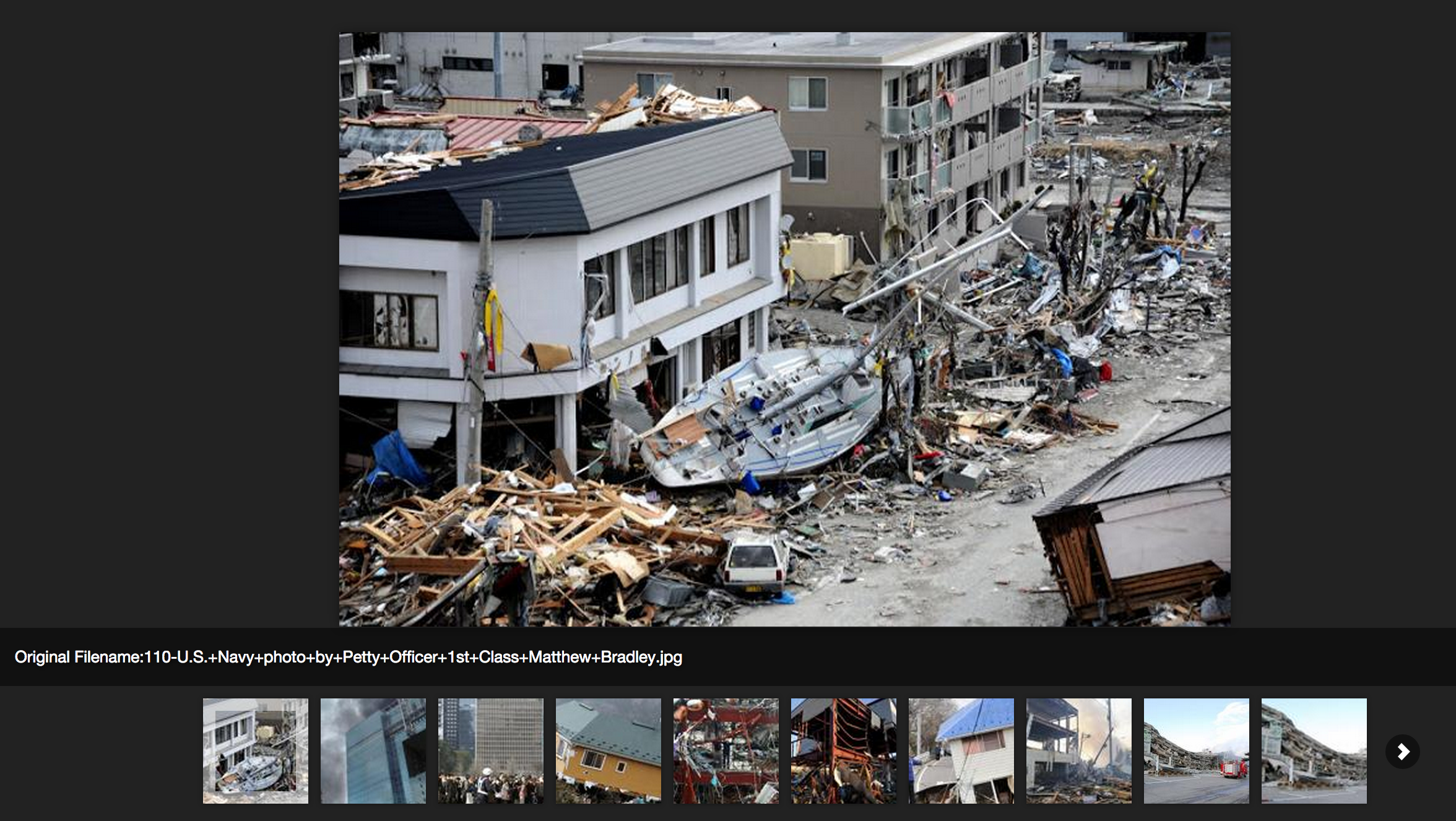
(1) Global Disaster Scenes from Internet
This is an ongoing research product with a focus in collecting imagery data from the Internet (including social networks) that reflect the damage of built environment and civil infrastructure as complex scene (imagery) data. This project serves two purposes: (1) the databases (based on MongoDB) will have a cross-platform web portal ready for open access by researchers; and (2) our ongoing research in deep understanding of disaster scenes. A temporal website is found here: https://sites.google.com/site/globaldisasterscenes/
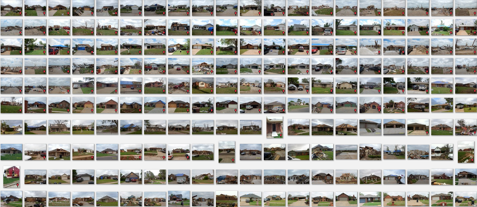
(2) 2013 Moore Tornado Scene Damage Learning Databases
- Post-Tornado Scene Images (all images are damage-labeled) : ground based post-tornado images for individual buildings. Each image (building) is manually labelled by damage levels (1 to 4 with 4 being collapsed or leveled, 3 being severe damage, 2 moderate, and 1 being minor to intact) and described by a short description. Also each building was geo-tagged with manually adjusted lat/long coordinates. For a better view, click here.
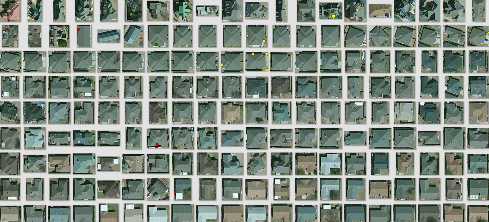
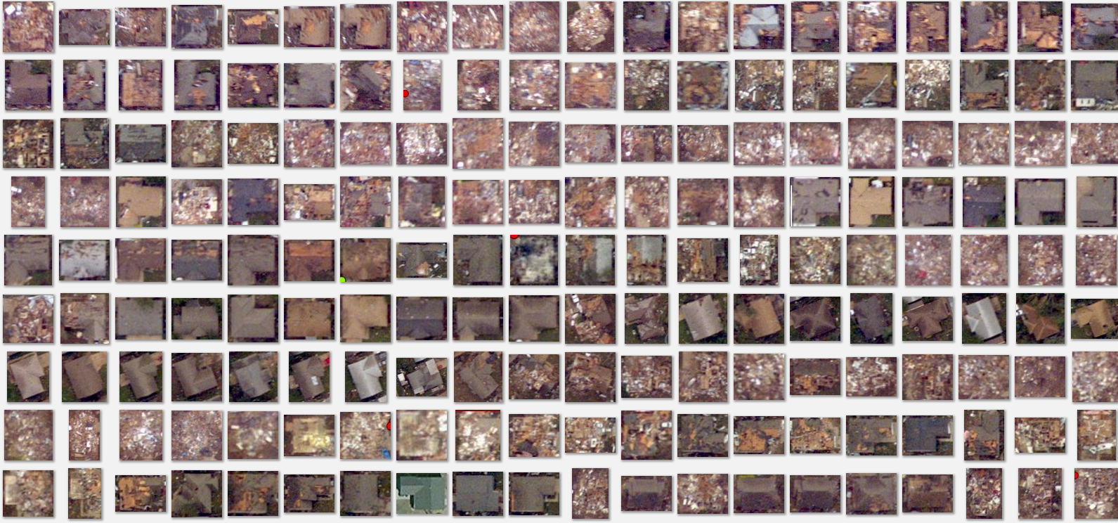
- Pre-/Post-Disaster Aerial Imagery Patches. Aerial views of the post-tornado image patches of individual buildings were created in terms of pre and post-disaster images. This imagery set was designed for validating object-based change learning . For better views, click here: pre imagery data and post imagery data.
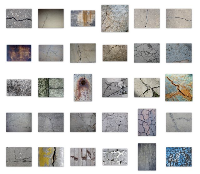
(3) UMKC Concerete Damage Imagery
A small concrete imagery database collected on UMKC campus for our development of intelligent infrastructure surface damage evaluation algorithms.
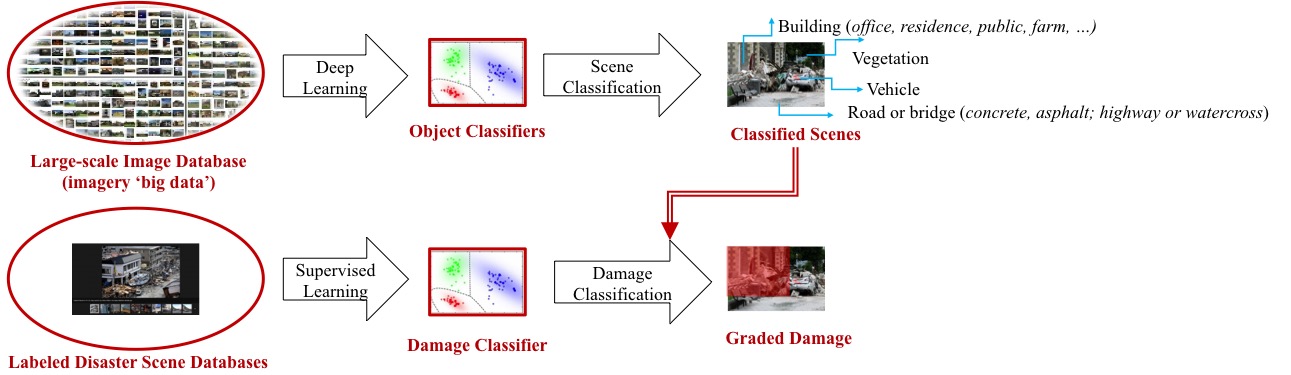
(4) Computational Damage Scene Understanding
We have successfully tested a disaster object bank approach to learning from a moderate-sized imagery disaster databases for labeling different levels of building damage. In the long run, we aim to construct a big-data enabled computational framework that automates semantic description of disaster scene and engineering-meaningful damage level grading.
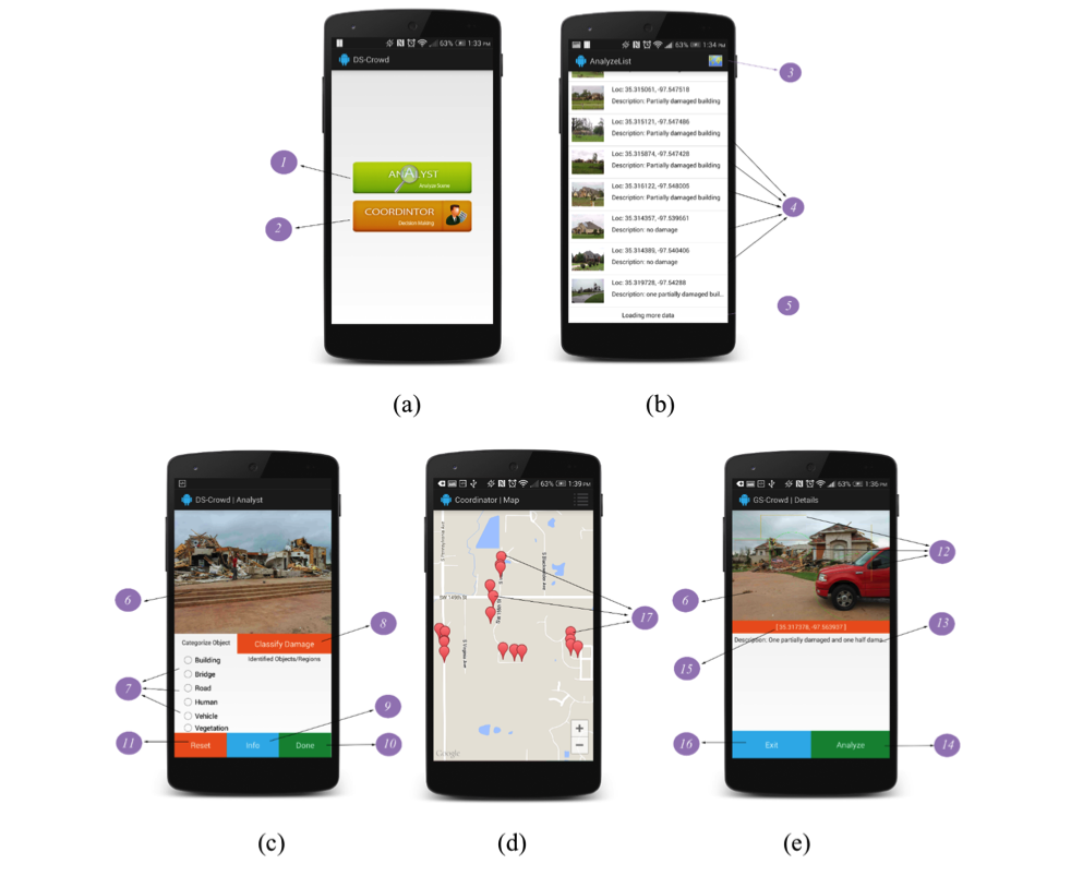
(5) Crowd-based Disaster Scene Understanding (DS-Crowd) (Tutorial: https://laser.umkc.edu/smart-app-disaster-scene-crowdsourcing)
(6) 2014 South Napa Earthquake Field Reconnaissance using drone imaging and damage scene crowdsourcing (under construction)